|


|
Investigation of Microphysics and Precipitation for Atlantic
Coast-Threatening Snowstorms (IMPACTS)
|
|
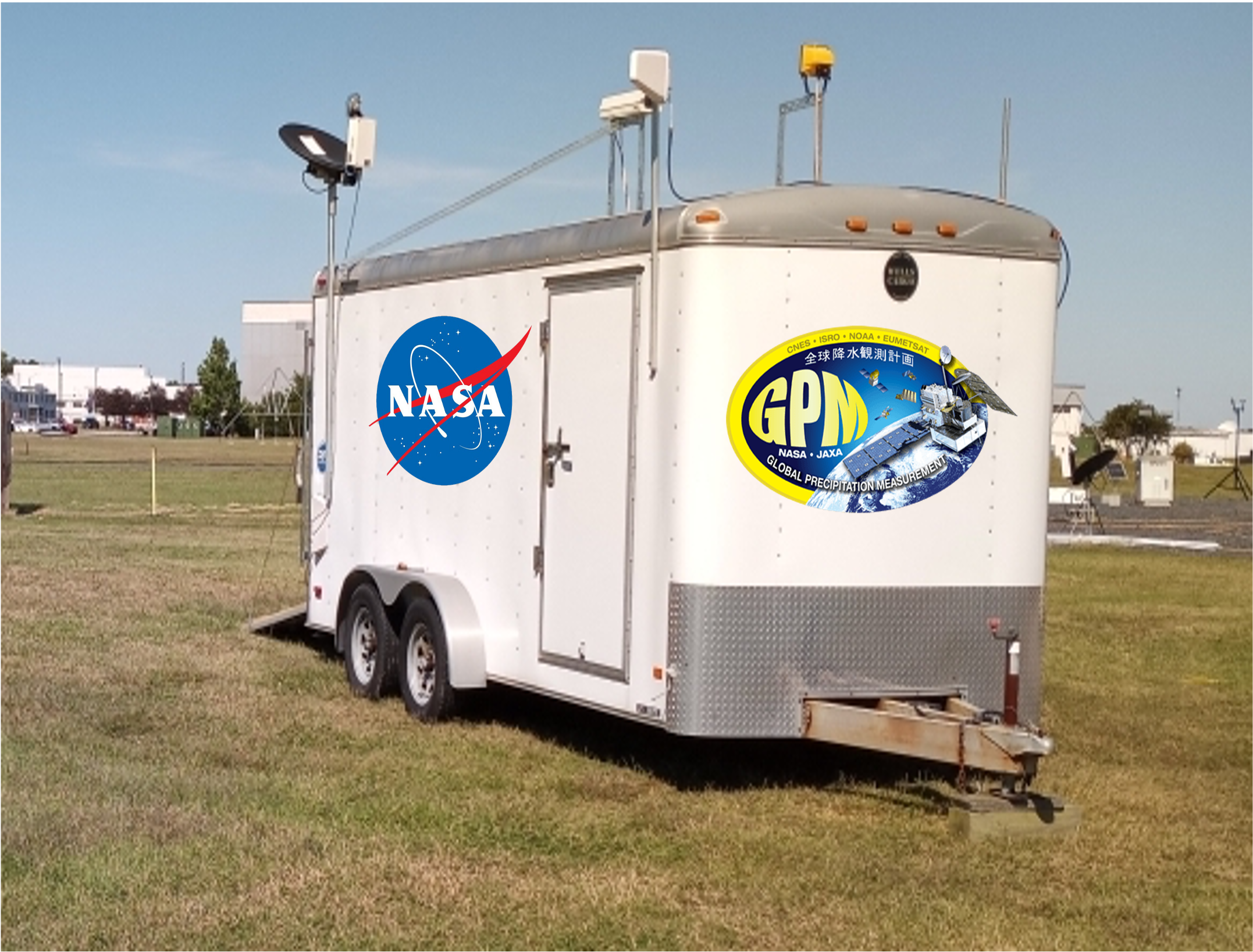
From the the ESPO IMPACTS Site..." (IMPACTS) will fly a complementary suite of remote sensing and in-situ instruments for three 6-week deployments on the ER-2 and P-3 aircraft. IMPACTS will address three specific objectives, providing observations critical to understanding the mechanisms of snowband formation, organization, and evolution. IMPACTS will also examine how the microphysical characteristics and likely growth mechanisms of snow particles vary across snowbands. IMPACTS will improve snowfall remote sensing interpretation and modeling to significantly advance predictive capabilities. In a synergistic effort GPM has deployed a suite of precipitation-measuring instruments to the University of Connecticut (Storrs, CT). The instruments were deployed on Dec. 18, 2022 and it is envisaged that they will remain there through mid-March of 2023. This year GPM GV will provide instruments at two site: GAIL and D3R. GAIL: PIP, All-in-One, Pluvio, MRRPro, Gauges, Parsivel Disdrometer, Camera, and anemometer D3R: D3R, PIP, All-in-One, Pluvio, MRRPro, Gauges, Parsivel Disdrometer, Camera, and anemometer In addition GPM GV has several instruments located at or near NASA Wallops Flight Facility in support of the Wallops/GPM Precipitation Research Facility. Scroll down the page to learn more about the instruments, measurements and locations. |
NOTE on Quick Look Products
The images and data provided below are for quick look review and are not suitable for scientific analysis. Once the data has been quality controlled, they will be release to the general public at no cost. If you have questions, please contact the GPM Deputy Project Scientist for Ground Validation: David.B.Wolff_at_NASA.gov.GPM/IMPACTS Deployment at UConn
The GPM/GV Team at NASA Wallops Flight Facility have deployed two sites near the University of Connecticut in Storrs, CT. These two sites are designated by GAIL and D3R. The GAIL site (GPM Atmospheric Instrumentation Laboratory) hosts a suite of precipitation measuring instruments, including a Micro Rain Radar (MRR), Precipitation Imaging Package (PIP), Pluvio snow gauge, rain gauges, All-in-One [temp, press, humidity, wind], Anemometers and Parsivel (APU) disdrometers.
Live Camera from GAIL Site
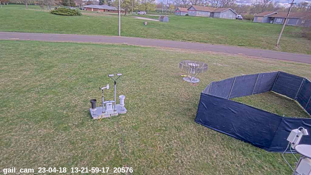
Click on image to see current daily movie!
NOTE: First available movie is on 01/05/2023.
NASA Radars
|
NASA's S-band POLarimetric Radar (NPOL)NPOL is NASA's premier weather radar. It is one of only two mobile S-band dual-polarization radars (the other being NCAR's SPOL). It is currrently deployed at its home location near NASA Wallops Flight Facility in Newark, MD in support of the GPM Precipitation Research Facility NPOL has a wavelength of 10.65 cm, an operating frequency of 2700-2900 MHz, variable PRF of 500 and 1000 Hz with a 0.95 degree beam width. The radar has a prime-focus parabolic reflector which is 8.5 m in diameter.You can view quicklook images and animation here or click the image of NPOL to the left. |
|
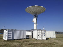
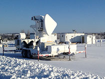
Dual-polarization, Dual-frequency, Doppler Radar (D3R)D3R is NASA's Ka/Ku Dual-polarization, Dual-frequency, Doppler mobile radar. During the winters of 2023, D3R was located in Storrs, CT to support ground observations for the Investigation of Microphysics and Precipitation for Atlantic Coast-Threatening Snowstorms ((IMPACTS) In a synergistic effort GPM has deployed a suite of precipitation-measuring instruments to the University of Connecticut (Storrs, CT). The instruments were deployed on Dec. 18, 2022 and it is envisaged that they will remain there through mid-March of 2023. This year GPM GV will provide instruments at two site: GAIL and D3R.You can view quicklook images and animation here or click the image of NPOL to the left. |
Micro Rain Radar
According to Metek...The Micro Rain Radar MRR at 24 GHz is a unique meteorological radar profiler for Doppler spectra of hydrometeors in height ranges 15 m ... 6000 m. The high resolution in time and height enables the MRR to monitor the genesis of frozen hydrometeors, the melting zone (bright band) and the formation of rain drops. With the derived rain rate the MRR offers a calibration of weather radar. The MRR has been adapted even for monitoring of avalanches and volcanos.
|

|
Latest daily plot from MRRPRO-06 (GAIL, left) and MRRPRO-07 (D3R, right)
Daily plots generated by GPM GV group.
NOTE: These files are 100-200 MB each. Daily NetCDF files of MRRPro data. These files are compressed (gzip) but contain daily data rather than the hourly raw data. Python users can read these data, once uncompresses using Xarray...
import xarray as xr
ds = xr.load_dataset(filename)
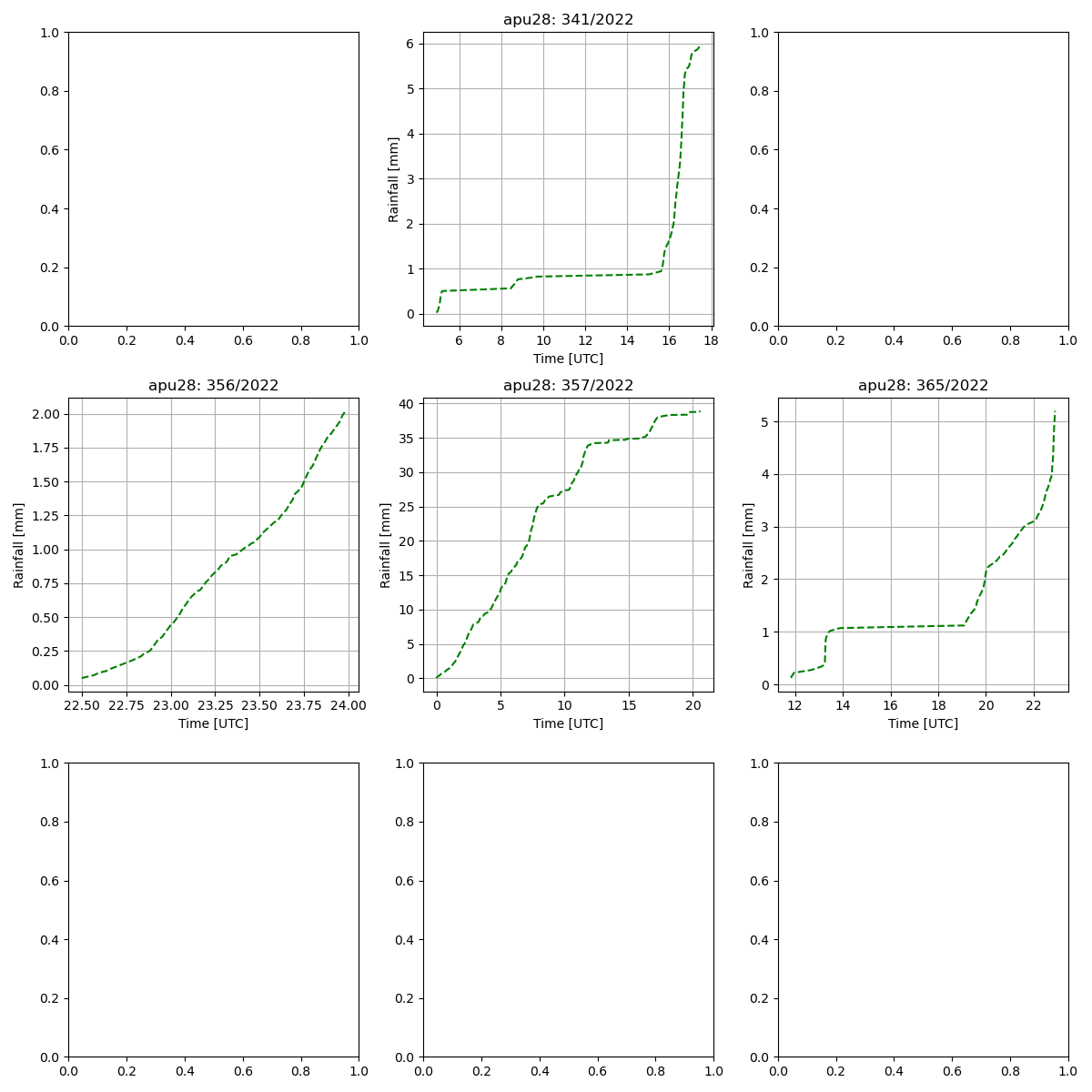
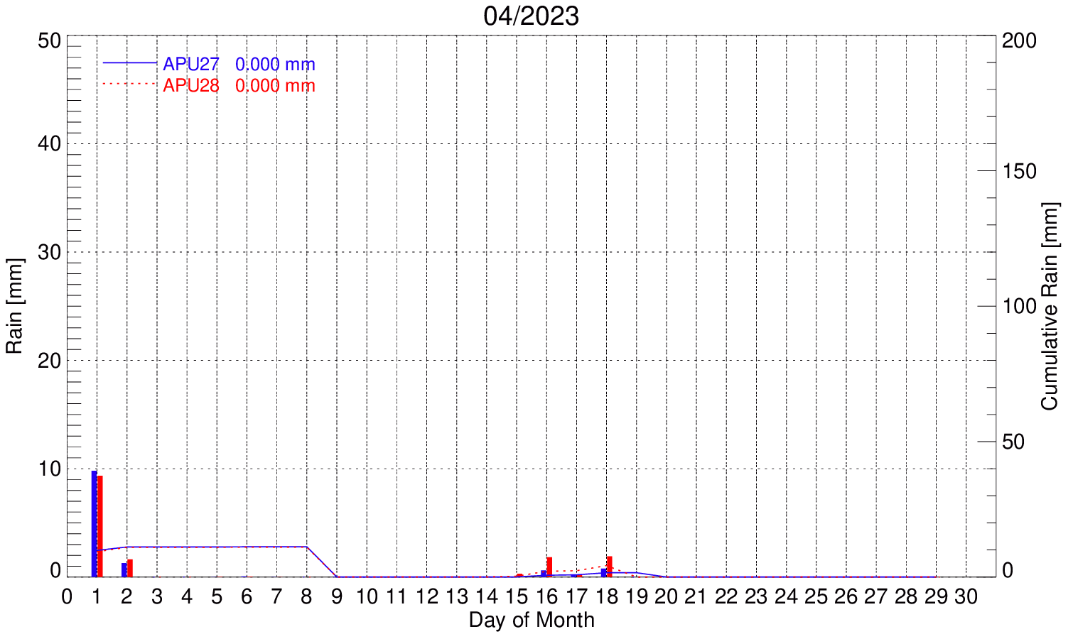
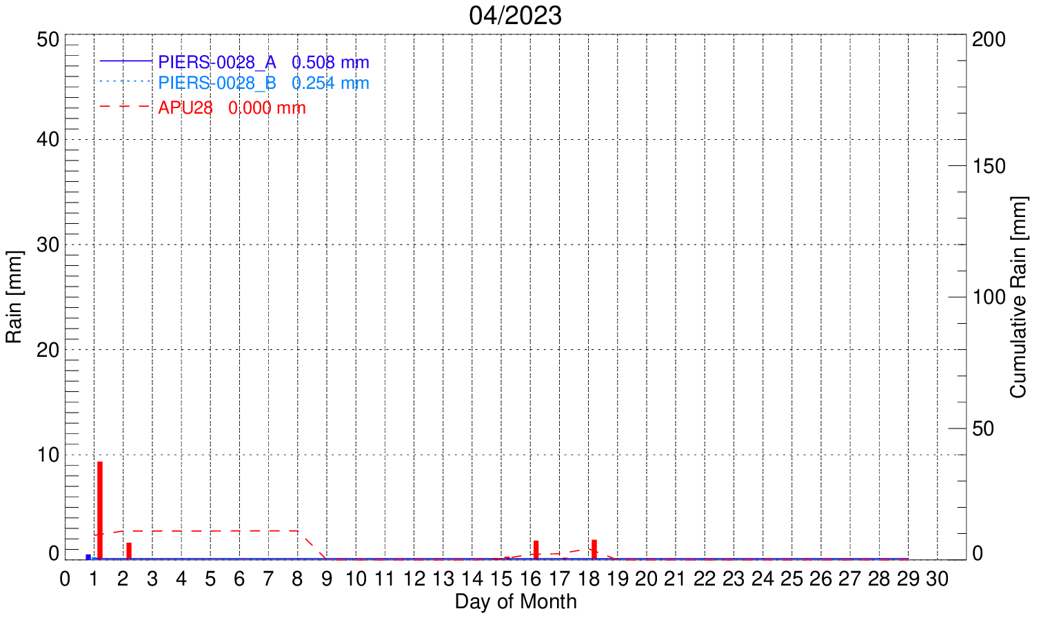
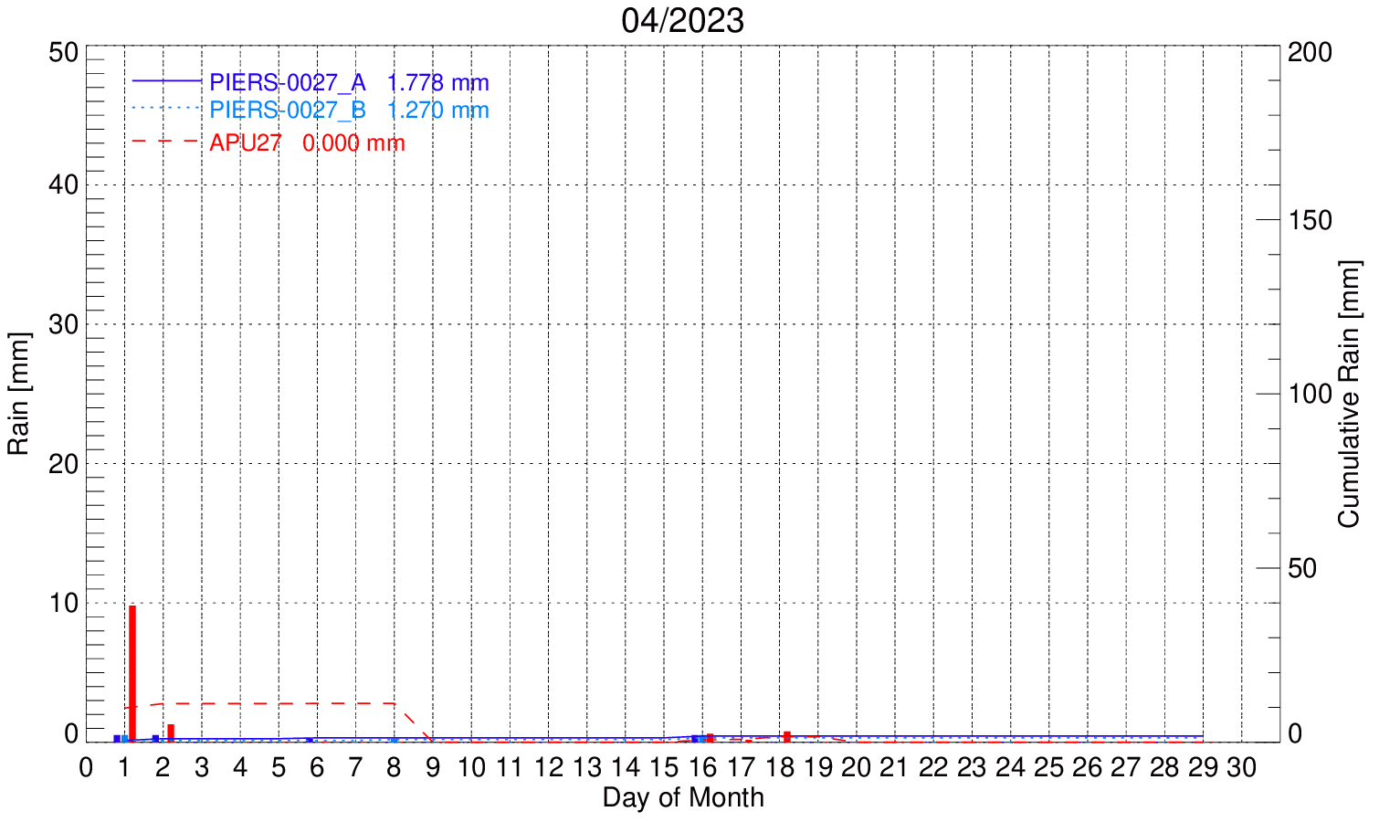
Parsivel Disdrometers (APU)
According to OTT Hydromet...The OTT Parsivel is a modern laser disdrometer for comprehensive measurement of all precipitation types. The Parsivel captures both the size and speed of falling particles, classifying them into one of 32 separate size and velocity classes. The raw data are used to calculate the type, amount, intensity and kinetic energy of the precipitation, the visibility in the precipitation, and the equivalent radar reflectivity.

|

|
Latest daily plot from APU28 (GAIL, left) and MAPU27 (D3R, right)
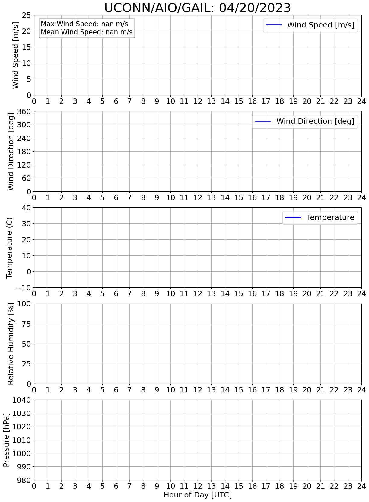
All-in-One (Temperature, Humidity, Wind)
According to MetOne...The AIO 2 Weather Sensor provides measurements of wind speed, wind direction, ambient air temperature, relative humidity, and barometric pressure in a single, compact, rugged unit. It integrates a folded-path, low-power sonic anemometer with a precision thermistor temperature sensor, fast-response capacitive relative humidity sensor, and a state-of-the-art barometric pressure sensor. It also includes an internal flux-gate compass that allows for automatic alignment of wind direction to magnetic north, regardless of the sensors orientation.
|
|
RM Young Anemometer [D3R only]
Precipitation Imaging Package (PIP)
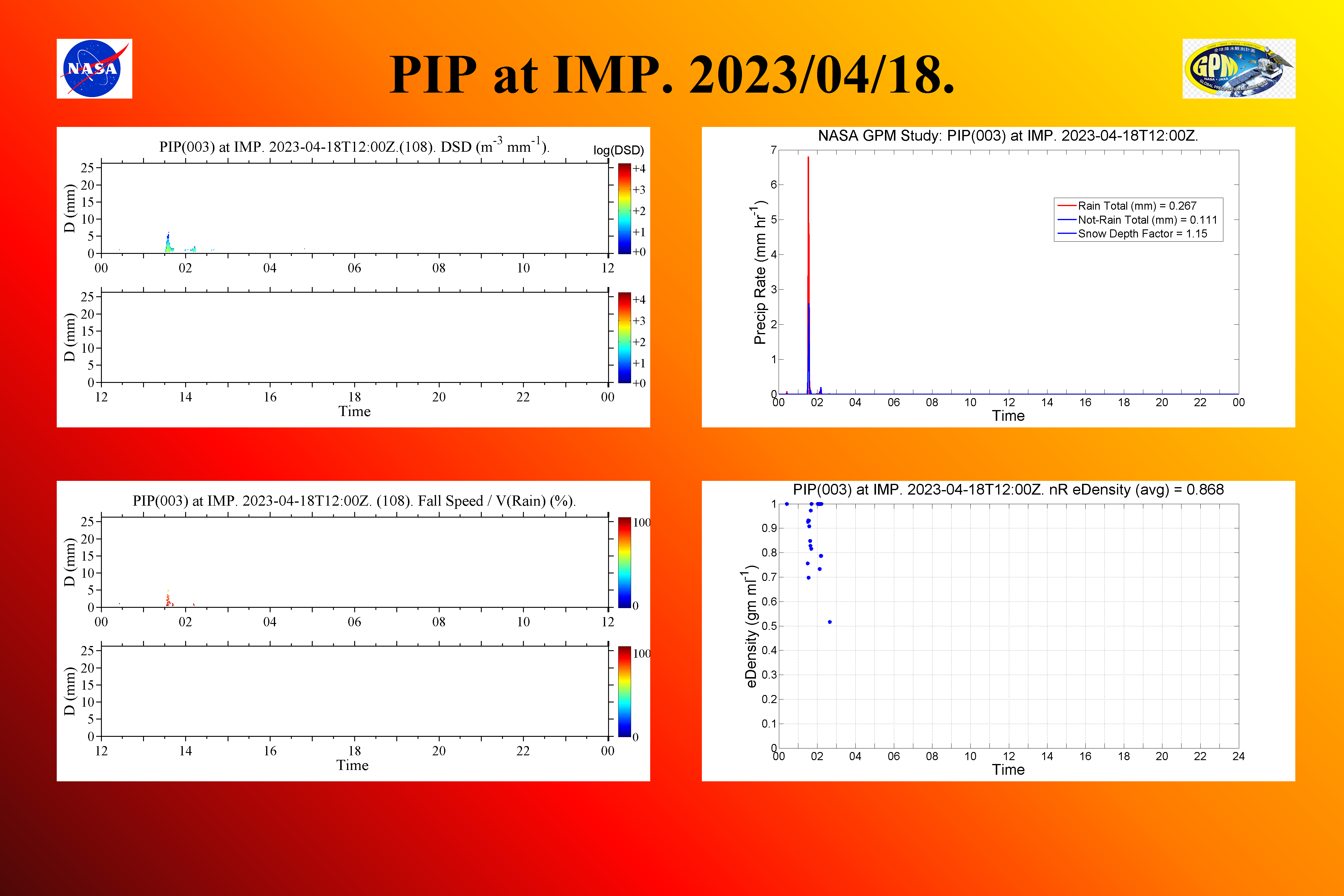
|
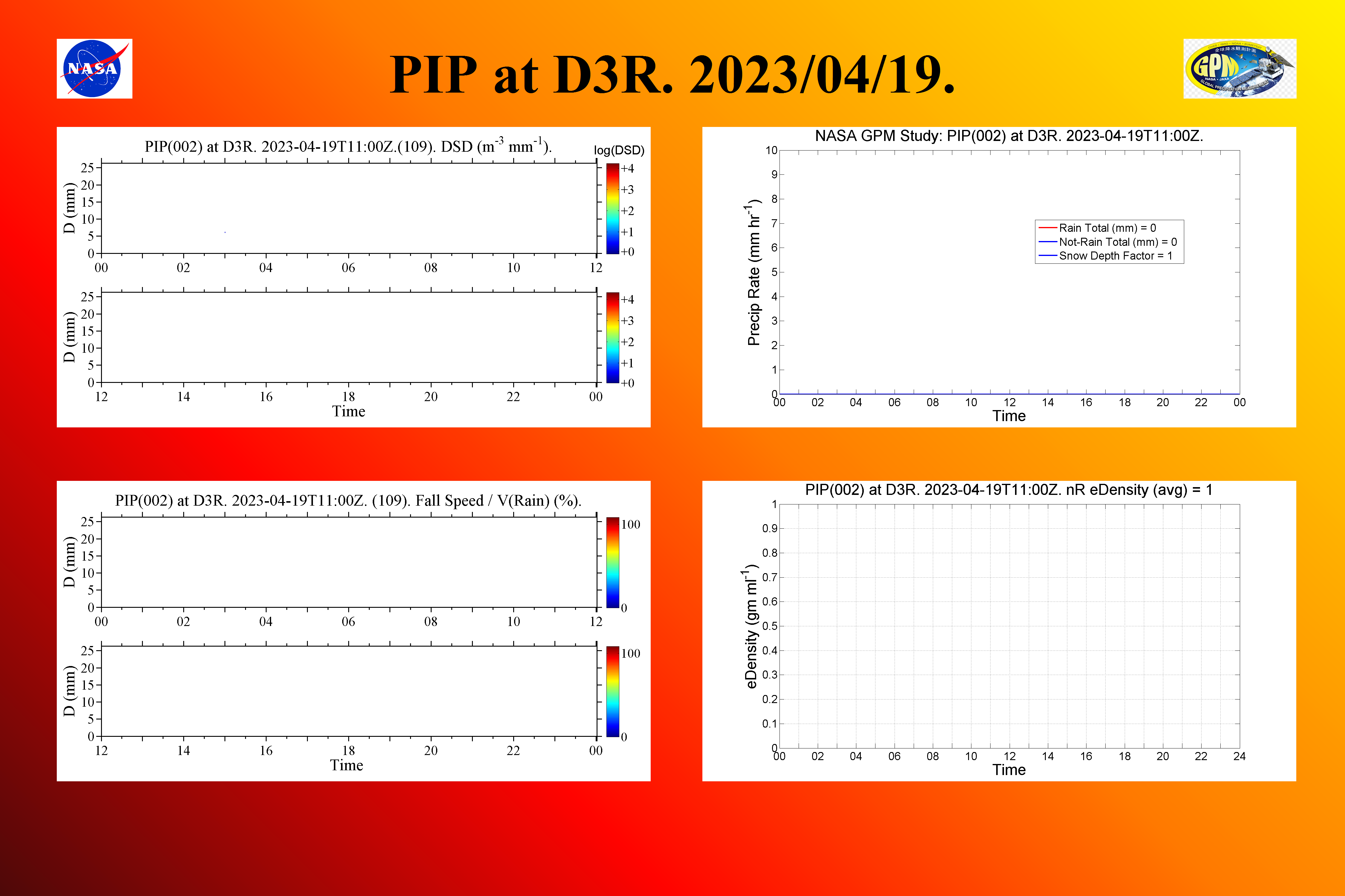
|
Note: First summary figures available on 01/09/2023
OTT Pluvio Weighing Rain Gauge
According to OTT Hydromet...The OTT Pluvio² is an all-weather precipitation gauge that uses superior weight-based technology to measure the amount and intensity of rain, snow, and hail. Developed in conjunction with industry-leading meteorological services, the OTT Pluvio² employs a high-precision load cell and algorithms that compensate for wind, temperature, and evaporation, ensuring the highest accuracy precipitation measurements over time.
|
|
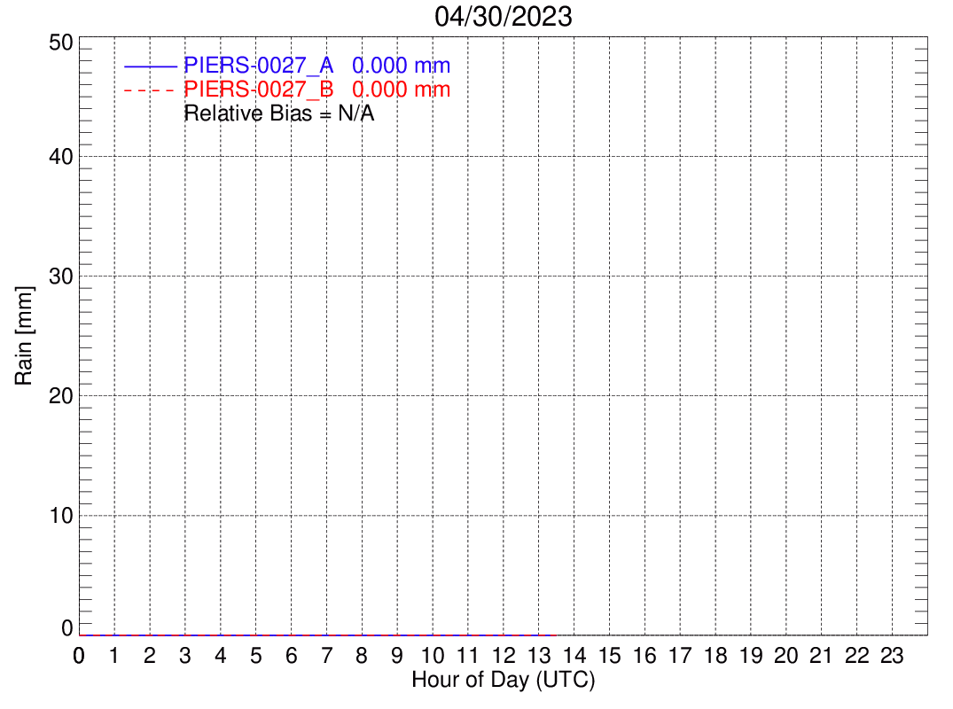
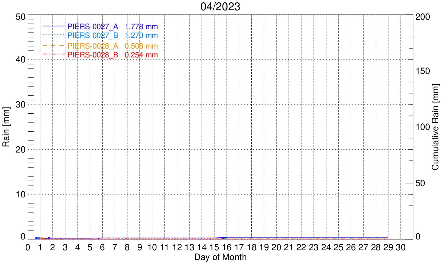
Rain Gauges
According to MetOne...The MetOne precipitation gauges measure rain and/or snow in all environments using a tipping bucket mechanism. The economical tipping bucket design allows accurate, repeatable measurements, requiring no regular maintenance. Each model in the 370D-380D Series is optimized to meet particular site and sampling requirements and exceeds EPA specifications.

|
|
|
|
|||
|
|
Gauge Data formats for GAG, 2A56 and GMIN files.
Rain Rate Interpolation Algorithm. Data users are referred to Wang et al. 2008 (J. Atmos. Oceanic Technol., 25, 43-56.) or contact Jianxin Wang (jianxin.wang@nasa.gov) for details on the 2A56 or GMIN interpolation algorithm and software.

|
Privacy Policy and Important Notices |
|
Web Curator: Jianxin Wang NASA Official: David B. Wolff |