|


|
BiLateral Operational Storm-Scale Observation and Modeling (BLOSSOM)
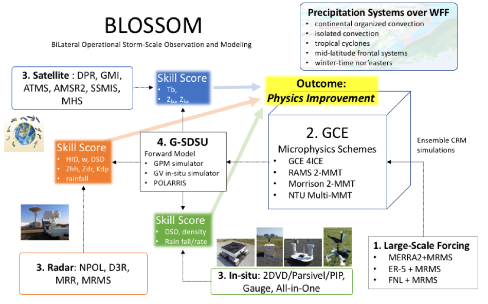
Over the past several decades, cloud-resolving models (CRMs) have been advanced
and utilized for many applications, such as the study of mesoscale convective
systems, cloud microphysics, cloud latent heating, and cloud radiative forcing,
all of which have been used to support the development of satellite algorithms
for the TRMM and GPM satellites (Tao et al. 2014). Yet, one of the long-standing
uncertainties in CRMs is the spatial-temporal distribution of bulk hydrometeors,
especially, mixed-phase and frozen precipitation.
BLOSSOM envisions the following goals:
|
|
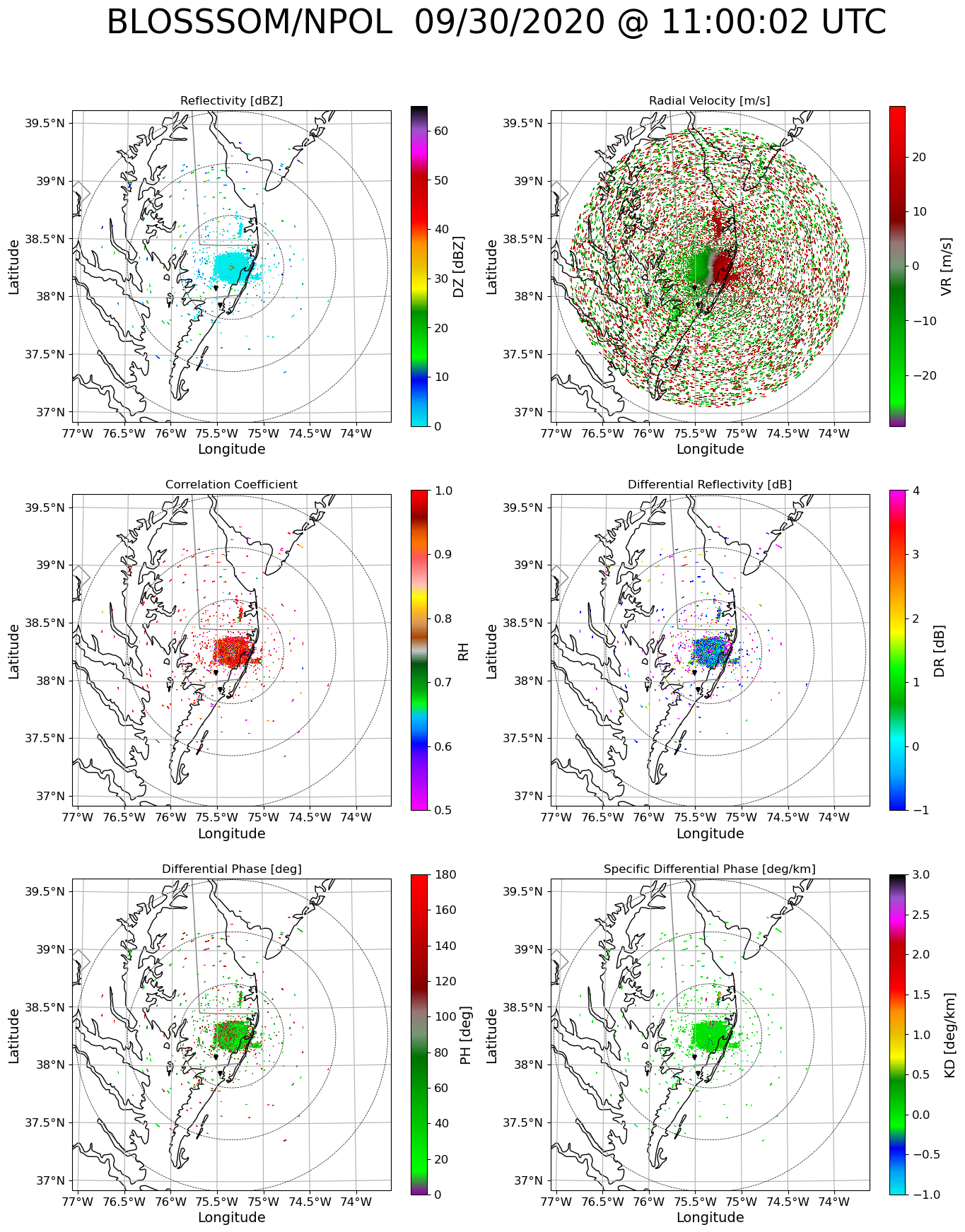
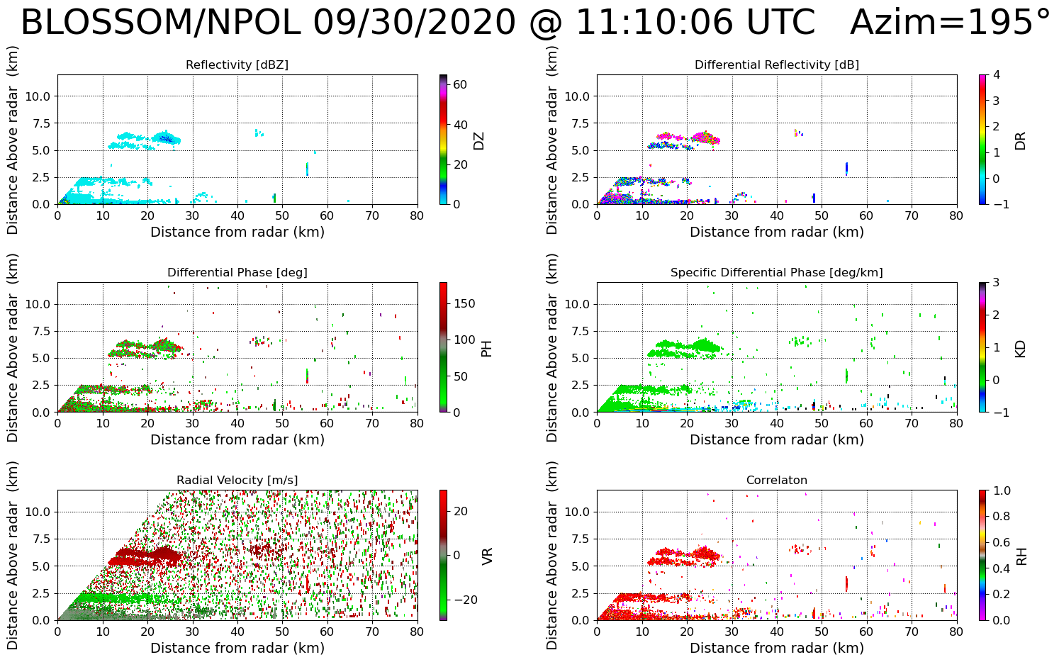
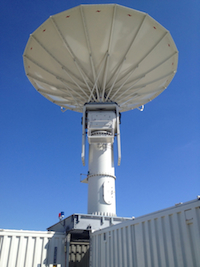
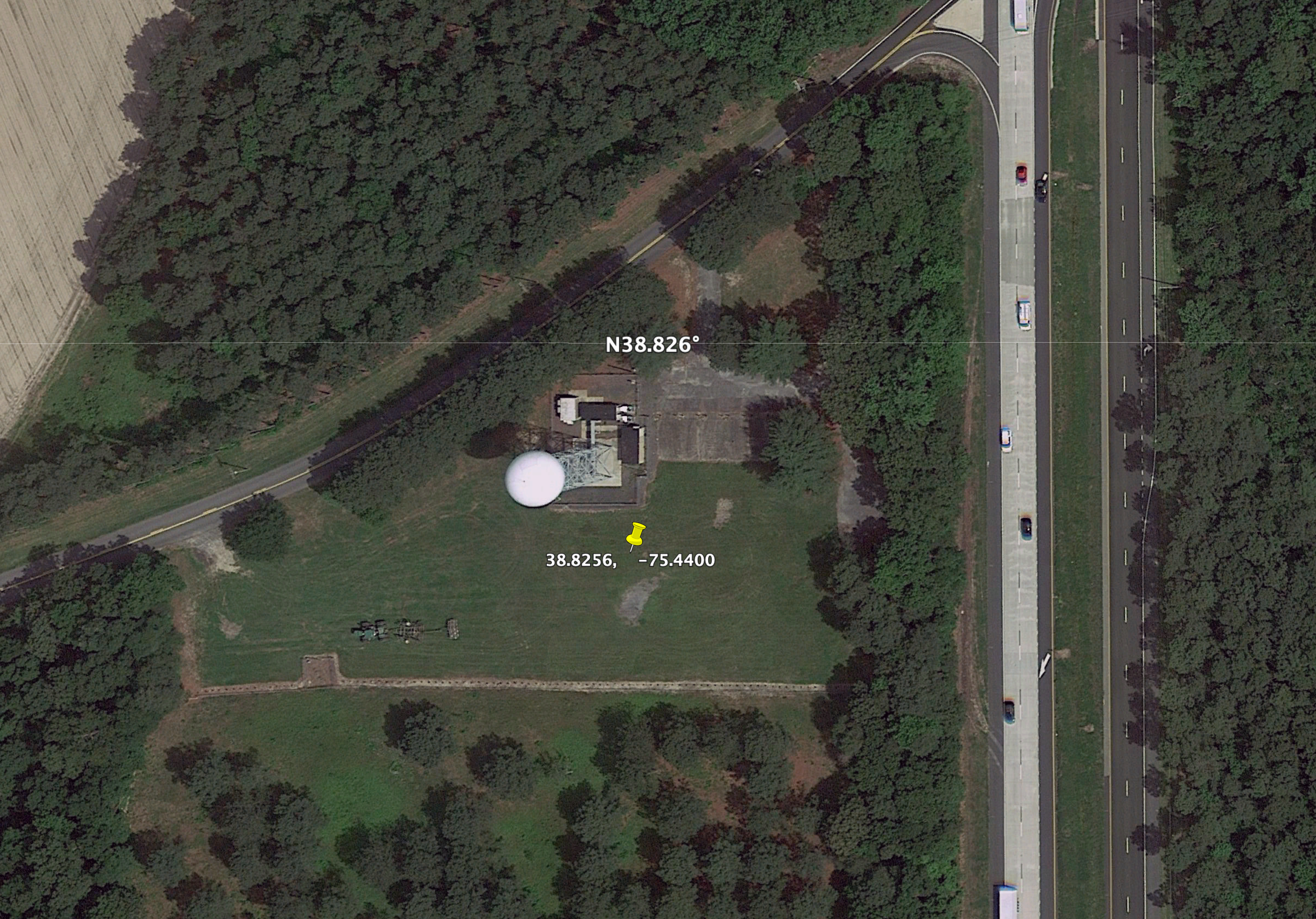
NASA Polarimetric Radar (NPOL)
NOTE:
Radar imagery on this page was generated using PyART
Helmus, J.J. and Collis, S.M., 2016. The Python ARM Radar Toolkit (Py-ART), a Library forWorking with Weather Radar Data in the Python Programming Language. Journal of Open Research Software, 4(1), p.e25. DOI: http://doi.org/10.5334/jors.119.
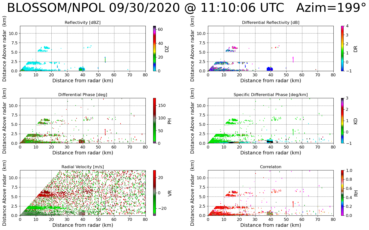
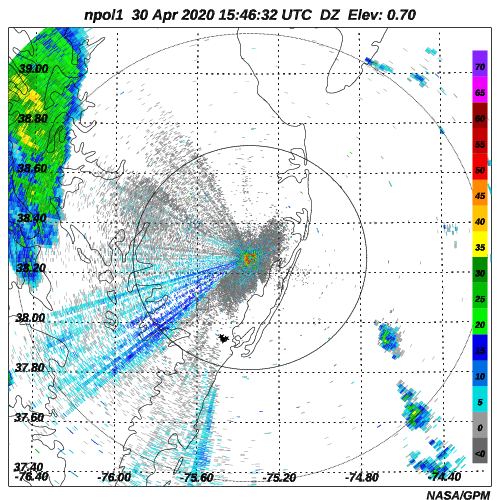
Latest NPOL Imagery
| PPI Images | RHI Images |
|
|
|---|
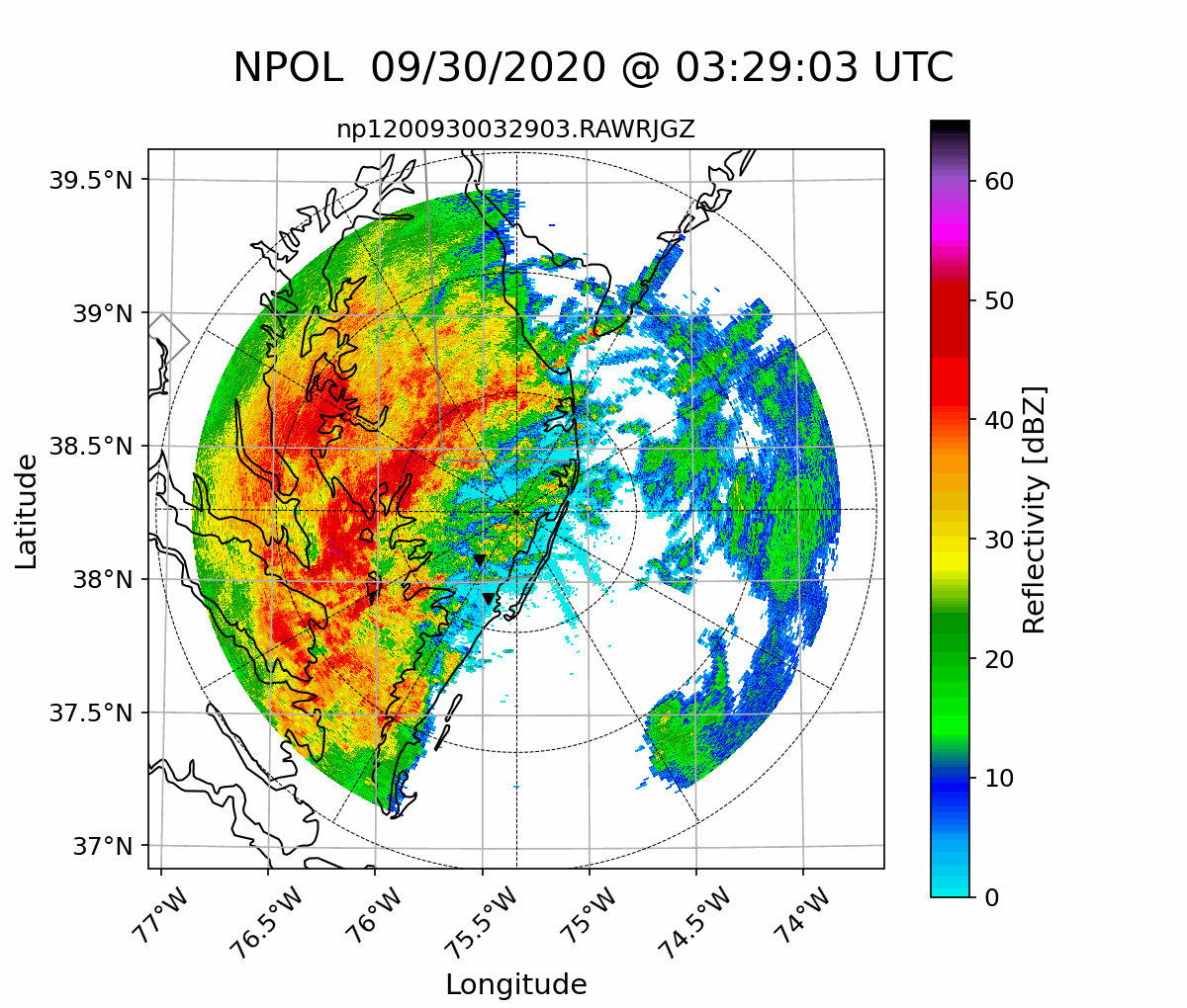
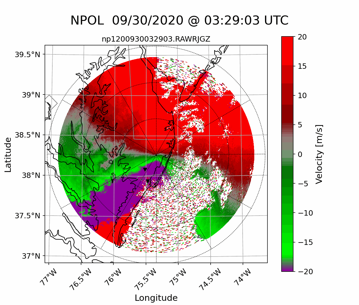
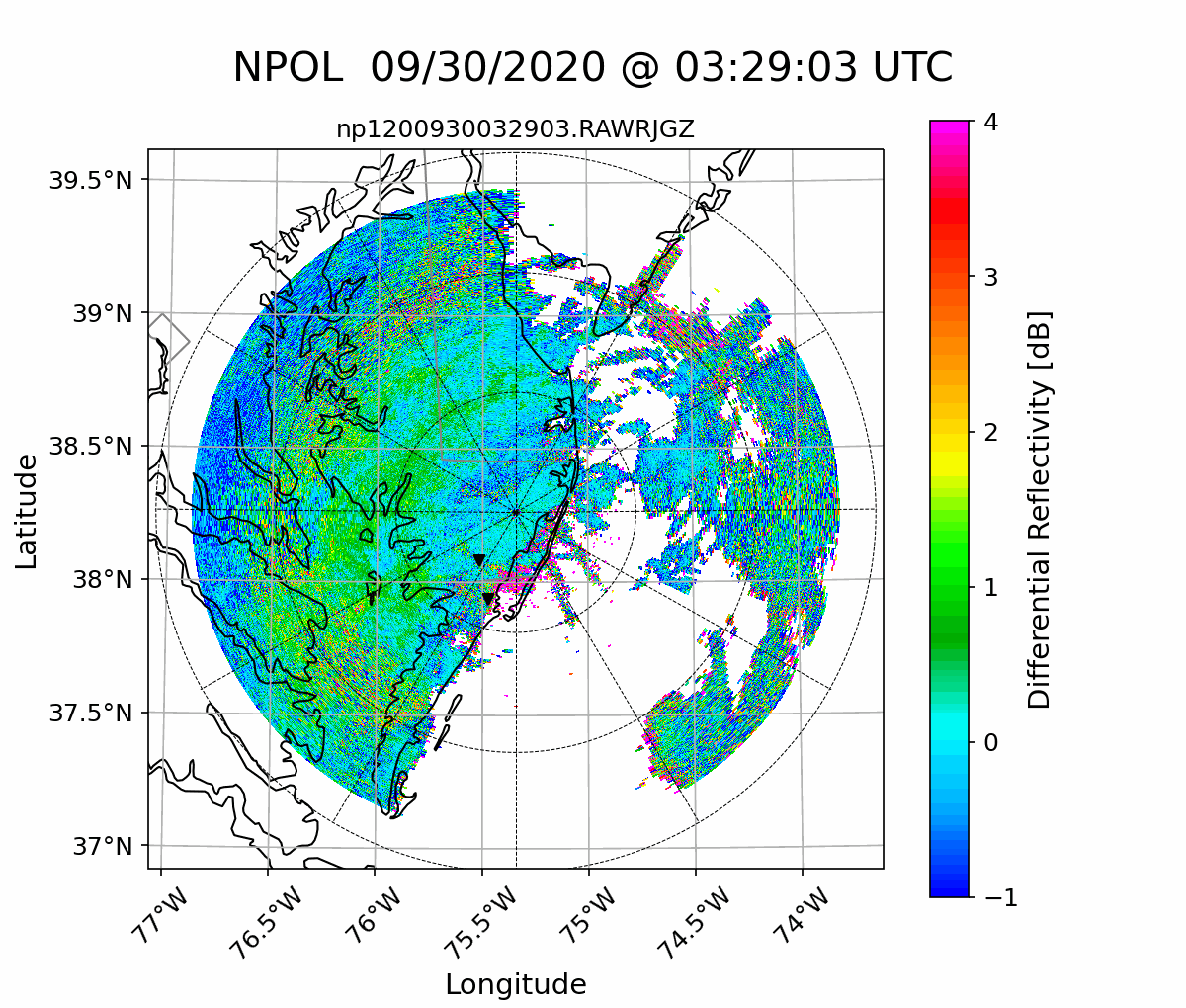
Latest NPOL Radar Animations
| Reflectivity [dBZ] | Radial Velocity [m/s] | Differential Reflectivity [dB] |
|
|
|
|---|---|---|
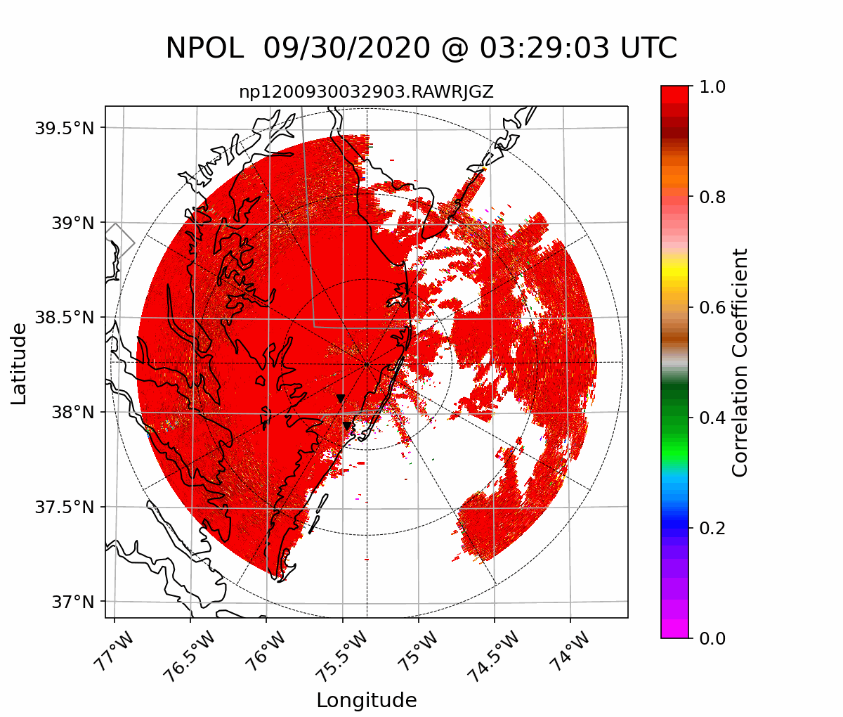
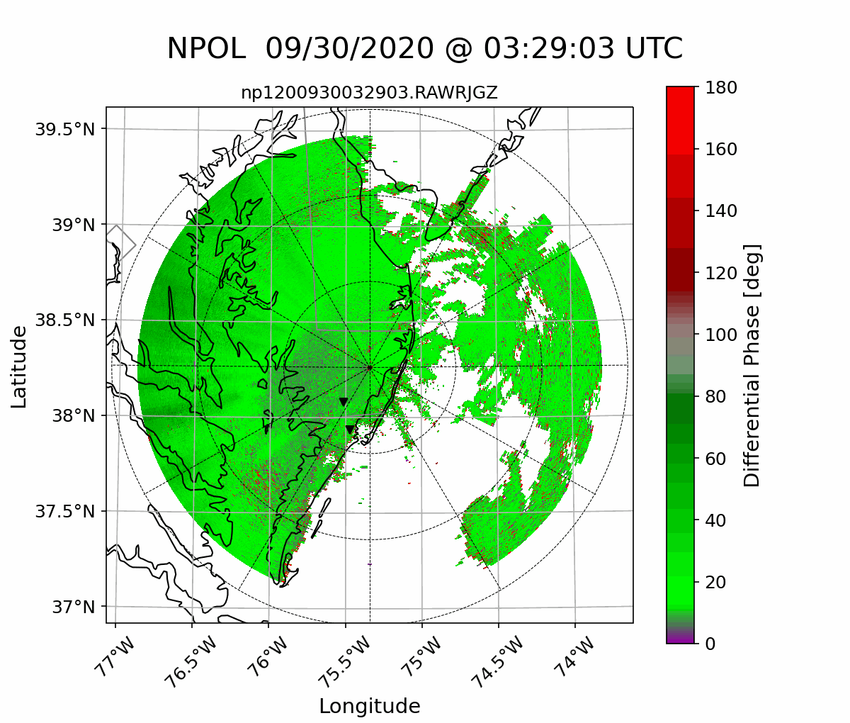
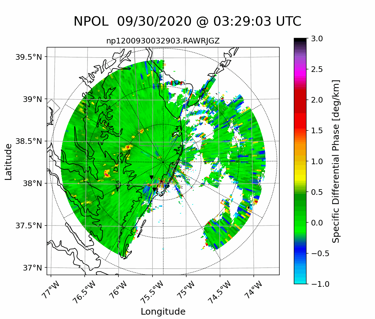
| Corellation | Differential Phase [deg] | Specific Differential Phase [deg/km] |
|
|
|
Click thumbnails to view animatewd gif!
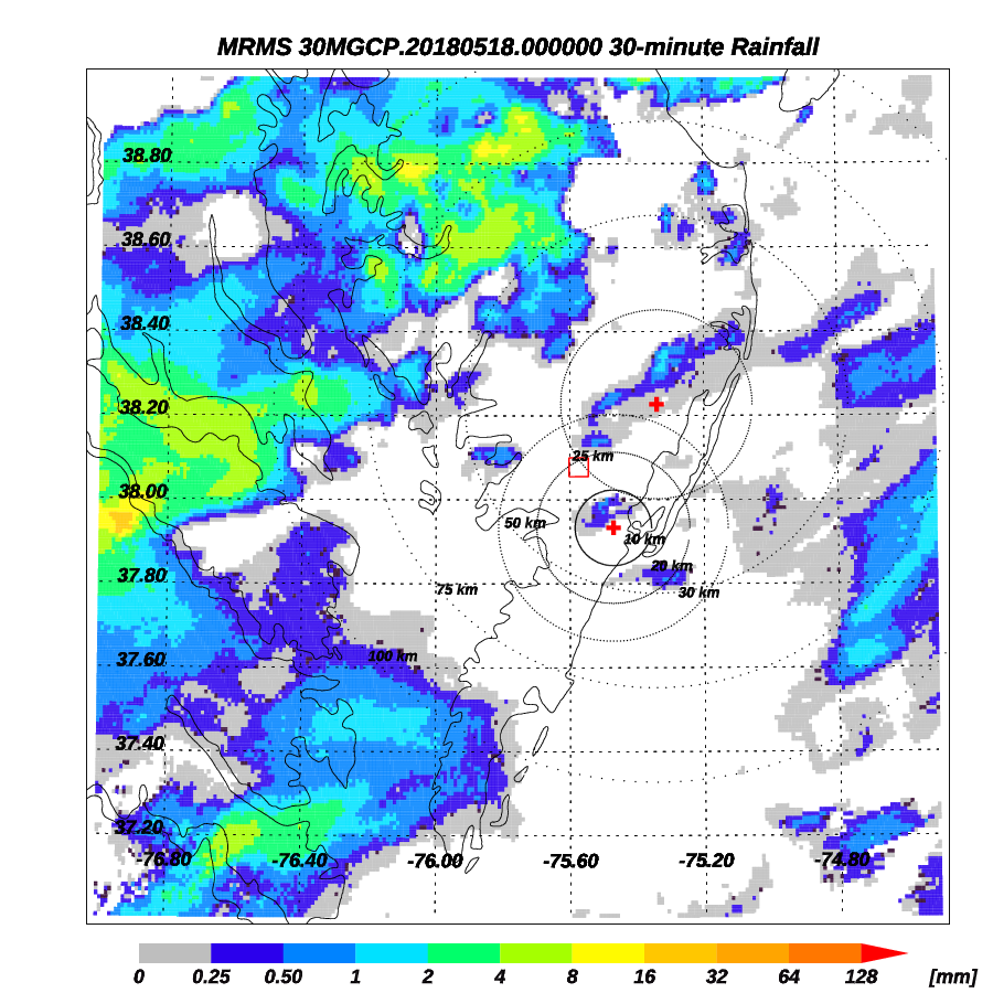
Multi-Radar Multi-Sensor (MRMS) Data over Wallops Region
|
The
Multi-Radar Multi-Sensor (MRMS)
project utilizes an automated system that rapidly and intelligently
integrates data from multiple radars and radar networks, surface
observations, numerical weather prediction (NWP) models, and climatology
to generate seamless, high spatio-temporal resolution mosaics.
Sample 30-minute MRMS Map Over Wallops Region |
|
|
NPOL is NASA's premier weather radar. It is one of only two mobile S-band dual-polarization radars (the other being NCAR's SPOL). When not being deployed for PMM/GPM field campaigns, it is operated near NASA's Wallops Flight Facility in Newark, MD. NPOL has a wavelength of 10.65 cm, an operating frequency of 2700-2900 MHz, variable PRF of 500 and 1000 Hz with a 0.95 degree beam width. NPOL can operate with both horizontal and vertical polarization in both simultaneous and alternating modes. The radar has a prime-focus parabolic reflector which is 8.5 m in diameter and is housed on five sea-tainers. When readied for deployment, the entire radar and antenna system is stored within the five seatainers.
|
|
Dover AFB WSR-88D (NEXRAD)
|
|
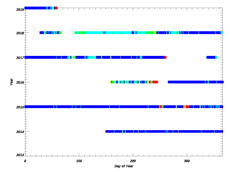
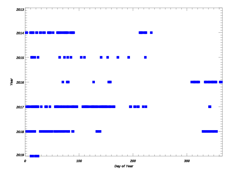
NPOL Case Studies
Click here to take a look at several initial case studies.

|
Privacy Policy and Important Notices |
|
Web Curator: jianxin.wang@nasa.gov NASA Official: David B. Wolff |